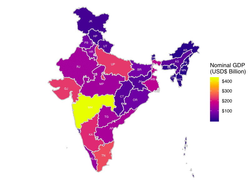
In support of Lesson 4 of the Social Cops Introduction to GIS in R online course, I created a shiny app to allow users to experiment with different geospatial representations, such as choropleths, cartograms and hexbin maps, using basic population and economic data from India’s states. Find the app at the button above or link below.
https://shiny.socialcops.com/indiastates/
The full lesson can be found here.
You can also find its Github repo.