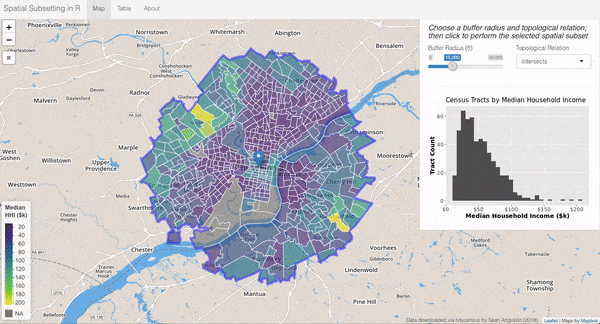
In support of Lesson 5 of the Social Cops Introduction to GIS in R online course, I created a shiny app to demonstrate the concept of spatial subsetting using median household income data from the Philadelphia metropolitan area. Find the app at the link below.
https://shiny.socialcops.com/spatialsubset/
The full lesson on spatial subsetting can be found here.
You can also find its Github repo.